Konjic
Konjic (Коњиц) is a city and municipality located in Herzegovina-Neretva Canton of the Federation of Bosnia and Herzegovina, an entity of Bosnia and Herzegovina. It is located in northern Herzegovina, around 60 km southwest of Sarajevo. It is a mountainous, heavily wooded area, and is 268 m above sea level. The municipality extends on both sides of the Neretva River. According to the 2013 census, city has a population of 10,732 inhabitants, with 25,148 inhabitants in the municipality.
The town is one of the oldest permanent settlements in Bosnia and Herzegovina, dating back almost 4000 years; the town in its current incarnation arising as an important town in the late 14th century.
The area near the town is believed to be settled up to 4000 years ago, and settlements around 2000 years ago by Illyrian tribes travelling upstream along the Neretva river have been found. Konjic was earliest recorded by name in the records of the Republic of Ragusa on 16 June 1382.
The town, part of the Bosnian kingdom, was incorporated into the Ottoman Empire, of which the lasting feature for the town (apart from the many mosques and bringing of Islamic faith) is the Ottoman-inspired bridge which features in the town's coat of arms, and later into the Austro-Hungarian Empire. After World War I, the town, along with the rest of Bosnia and Herzegovina, became part of the Kingdom of Serbs, Croats and Slovenes later renamed Kingdom of Yugoslavia in 1929. During World War II, the town became part of the Independent State of Croatia, and following the war joined the Socialist Federal Republic of Yugoslavia. Between 1953 and 1979, a 611 square-metre atomic bunker, dug 300 metres into a mountain, known as ARK, was built secretly by the government in the Konjic municipality.
The town grew significantly and prospered as a vibrant, multi-ethnic town with good transportation links (the town is on the railway between Sarajevo and the Adriatic Sea), the large Igman ammunition factory and Yugoslav Army barracks. These factors became one of the main reasons for the town’s conflict in the 1990s.
Map - Konjic
Map


Country - Bosnia_and_Herzegovina
 |
 |
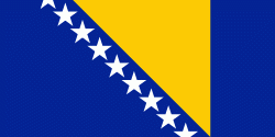
| Flag of Bosnia and Herzegovina | |
The area that is now Bosnia and Herzegovina has been inhabited by humans since at least the Upper Paleolithic, but evidence suggests that during the Neolithic age, permanent human settlements were established, including those that belonged to the Butmir, Kakanj, and Vučedol cultures. After the arrival of the first Indo-Europeans, the area was populated by several Illyrian and Celtic civilizations. Culturally, politically, and socially, the country has a rich and complex history. The ancestors of the South Slavic peoples that populate the area today arrived during the 6th through the 9th century. In the 12th century, the Banate of Bosnia was established; by the 14th century, this had evolved into the Kingdom of Bosnia. In the mid-15th century, it was annexed into the Ottoman Empire, under whose rule it remained until the late 19th century. The Ottomans brought Islam to the region, and altered much of the country's cultural and social outlook.
Currency / Language
| ISO | Currency | Symbol | Significant figures |
|---|---|---|---|
| BAM | Bosnia and Herzegovina convertible mark | KM or КМ | 2 |
| ISO | Language |
|---|---|
| BS | Bosnian language |
| HR | Croatian language |
| SR | Serbian language |